Southbound, solo: the Americas - report by Adriaan
Through Canada
Camping, Canadian style
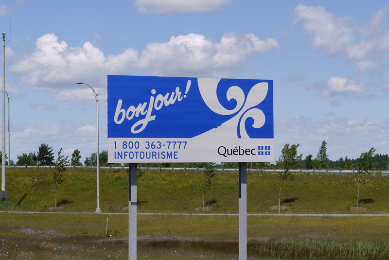
I reach Montréal readily (in the French-speaking province of Quebec) and drive a bit through the city. I quickly steer north because I want to cross Canada as north as possible. Did I have to search for campsites in America - here in Canada I stumble over them. The first one, with barriers that I conveniently pass, reminds me very much of Europe. When the kapo (a word for a person overseeing inmates in concentration camp) starts grumbling that I am not allowed to look until I have paid, the motorcycle has already worked its way past the exit barrier.
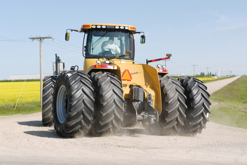
On the second one I succeed, and here too I see similarities. The plumbing is poorly built by a do-it-yourselfer and barely used. That's only natural, because of the fifty sites, there are two shabby little tents: one cyclist's and mine. The rest are full of trailers. People here have a pickup truck, preferably a little larger than a Toyota HiLux, with a coupling point in the body for that trailer: the caravan. Lengths of 6 meters and heights of 2.5 meters are no exception. Some have a “screened room” attached so they can sit insect-free “outside.
The sites are also set up for it: “3-way hookup pull through,” which means as much that electricity, water and sewage are available, and you don't have to park your combination in reverse somewhere. Those people never have to leave their trailer, and certainly not for the sanitary facilities. I hardly ever see them either, because whoever shows up outside is immediately besieged by an army of mosquitoes.
Planning
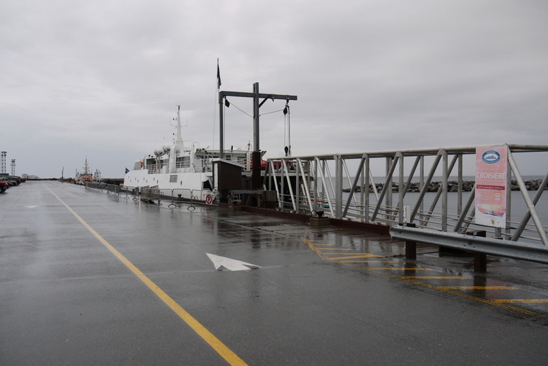
I may have stopped making a multi-day schedule, but sometimes a decision must be made. When I reach Rivière-du-Loup in the afternoon on July 6, I have not yet decided what to do. I misjudged the scale of my road map and the distances are about three times greater than I thought. I decide to sleep on it: cross the St Laurent River by ferry tomorrow morning at 8:15 a.m. and begin the trek to Alaska, or take the “wrong” direction and hit Nova Scotia after all. Everyone I talk to about it advises me to especially check out the northern tip (the most remote, of course): Cape Breton.
I trade the mosquito net for my wool inner suit from one of the waterproof rollers on the back of my bike. The previous afternoon was only 12°C - the north wind blew across the very cold river water, making it uncomfortable for those who thought it was summer. Clad in wool and in my rain suit (against the wind), the temperature will no longer bother me.
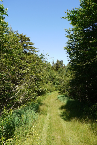
I decide, when I am awake again, to take the “wrong” road. I leave Quebec via a mountain ridge (an offshoot of the Appalachian Mountains) and enter New Brunswick. I follow the Rivers and Lakes route there, which takes me on secondary roads through the beautiful surroundings. The landscape is mountainous without being too steep. It rains occasionally (but I don't mind) - it is green everywhere. Water collects in rivers that “pause” here and there in a lake during their descent. There is apparently a lot of the black soil in the rivers: the water is quite brown everywhere.
Here, in the countryside, people live a lot in houses brought in by truck. They are wooden houses, assembled in a factory, so that on the “building site” the only work that needs to be done is for a foundation (sometimes a slab of concrete, but sometimes just eight sturdy legs) and for the connections (water and electricity). Although these houses are certainly not all alike, it is striking that they are all the same length and width, or twice the width (for houses transported in two halves). Apparently, the size of such houses is partly determined by traffic laws.
Do not think, that people live here is some kind of upgraded caravans - some of the houses look very nice, and are almost always on spacious plots of land with neatly trimmed grass. Even though the weather is not fantastic (today), there is a lot of outdoor living here: almost every house has a furnished patio (sometimes part of which is “closed” with netting - against insects) and almost everyone has a (gas) barbecue.
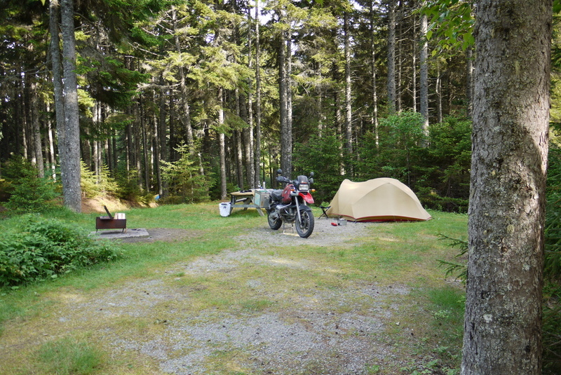
On July 8, I reach 'Fundy' National Park ( named after the river of the same name) about lunchtime. It feels so good that I immediately decide to stay. These park managers did understand the difference between a tent and a mobile home. The (many!) tents are separate and it is nice and quiet. No loud music, no loud central heaters and no air conditioners.
I am greeted almost immediately by the resident squirrel who comes to see what strange fabric thing I am building in his territory. In the evening, when I am almost asleep, he is still curious: he crawls under the outer tent and clambers up against the mesh of the inner tent.
I decide to go hiking the next day. If I had made a schedule, it would have been messed up now, because I am not even in Nova Scotia yet, let alone in the direction of Alaska....
Hiking
There are many hiking trails in the park, which are summarily described on a map given to anyone who pays park admission. I consult with one of the rangers. I do want to go to two lakes, via a trail marked as “difficult” (3 on a scale of 1 to 4). “It's not too bad - they are old logging roads,” he says. In just over an hour and a half, I negotiated the trail to two lakes teeming with green frogs. Along the way I saw many toads hopping away, had to deviate once from the neatly constructed road because beavers had built a dam that caused the road to become part of a small lake. “Nice hike,” I reflected, ”but a little too short.” The map had promised me three and a half hours.
The loggers needed reasonable paths for their trucks and harvesters, but the beaver dam detour is a real path through a dark forest. My map shows other trails, one of which is The Bennett River trail turn-off - pretty much like the beaver dam detour. This trail is “strenuous” (4 on a scale of 4), AND will lead me away from the campsite. On a whim, I decide that at the junction of the trail and the park road I will be able to hitchhike back to the campground (plusminus 18 km).
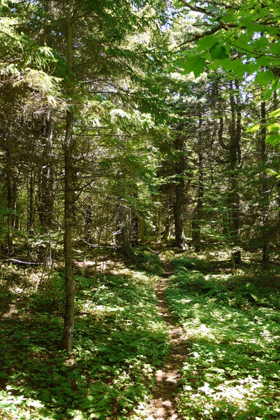
The trail is great: I have to descend to the Fundy River, on a path that is apparently very little traveled. It is so steep that there are hairpin turns. When the descent really begins I can hear the river, but I cannot see it yet. At the bottom I will have to ford the river - there is no bridge and the water may be too high. But my curiosity draws me further and further into the valley, even though I have neither sandals nor a waterproof bag for my palmtop computer and camera with me.
Arriving at the bottom, I take off my shoes and pants and leave them on the bank along with the electronics, while I test the depth of the water. The current pulls on me quite a bit: the water rises to the bottom of my thighs. I decide to do it, and a moment later I am standing barefoot, in my underwear, with my shoes around my neck and holding a bag high, in the middle of the river. It only just works out - it turns out to be more difficult when you can't use your arms to balance.
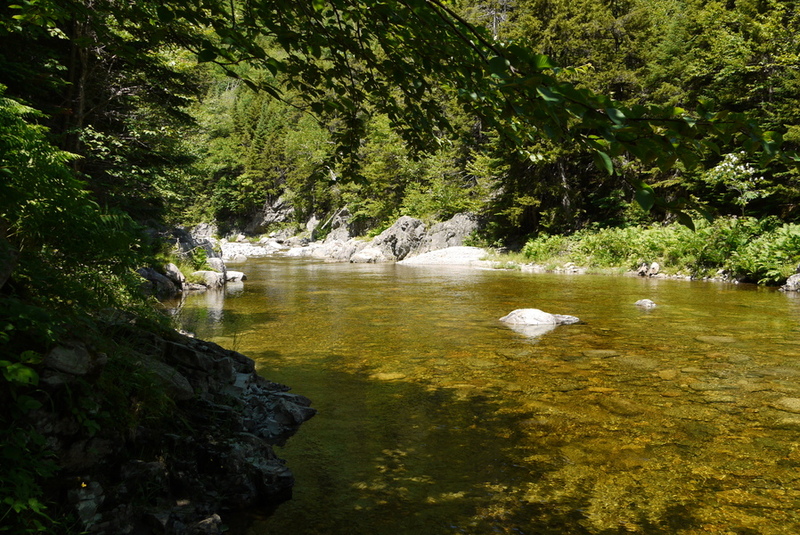
There is no path on the other bank and for a moment I doubt how to proceed. Soon it appears that I may cross again: the Bennet River flows through a waterfall into the Fundy. At the bottom of the waterfall is a deep pool: wading is out of the question. I climb the waterfall and after long hesitation jump from a very slippery rock over the waterfall. Not really responsible - I haven't seen anyone for hours - if something happens to me, help is not easily at hand. The climb on the other side is very tough: again hairpin turns in a very steep climb. Soon I run out of water. Fortunately, once at the top I find a stream with clear water (instead of the brown everywhere else) and can quench my thirst. Canadians distrust hitchhikers, but eventually, after three different rides, I arrive back at my little tent tired and fulfilled. A hike of 6 on a scale of 4, methinks.
Dirt or gravel?
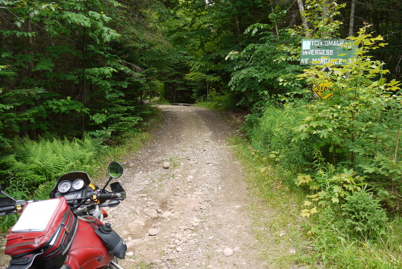
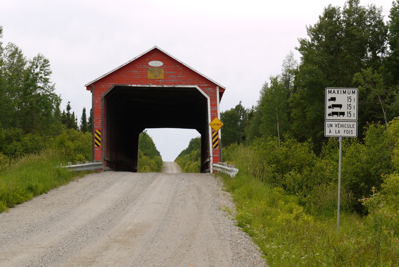
“Would that beautiful machine like to venture into that?”, asks the balding man in front of the church. “Oh well,” I say, ‘we're used to some!’. I'm on Cape Breton and I've completed the “mandatory” number: riding the Cabot Trail. The north of this island is a national park with a spectacular winding road along the coast. The only road there is full of souvenir stores, quilt knitting shops, and “artisan” art dealers. The park was worth it, but now it's high time to leave the beaten path. I have already enjoyed driving a few sections of gravel road. But I can't find the dirt road that is on my map and I stopped in front of a little church. Translated with DeepL.com (free version) "Zou die mooie machine daaraan willen wagen?", vraagt de kalende man voor de kerk. "Och", zeg ik, "we zijn wel wat gewend!". Ik ben op Cape Breton en ik heb het 'verplichte' nummer afgerond: Het Cabot Trail rijden. Het noorden van dit eiland is een nationaal park met een spectaculaire kronkelende weg langs de kust. De enige weg ernaartoe is vol met souvenir winkeltjes, quilt-breierijen, en 'artisanale' kunst handelaars. Het park was de moeite waard, maar nu is het hóóg tijd de gebaande paden te verlaten. Ik heb al met veel plezier een paar stukken grindweg gereden. Maar de onverharde weg die nu op mijn kaart staat kan ik niet vinden en ik ben gestopt voor een kerkje.
 “That road
does exist, but it is hopeless. I'll go get someone who knows about it”. A tall, balding man appears.
“What do you want to do?” I explain that I want to get off the main roads and am following the small,
gray lines on my map. I point to one I drove a half hour ago. “That's a 'dirtroad,'” I say. “There are no
dirtroads here,” he says, ‘except the one over there,’ and he points out exactly the one I couldn't find.
Aha. An unpaved road is a “gravel road”; a hopeless road is a “dirt road. I now know where to go. “Across
the river, then a bit south, then into the trail to the sports field.” I had already seen that turnoff:
there is (appropriately) a 'playground' sign next to it. Because that's what it is (for me). “It's a
waste of a beautiful motorcycle", he adds.
“That road
does exist, but it is hopeless. I'll go get someone who knows about it”. A tall, balding man appears.
“What do you want to do?” I explain that I want to get off the main roads and am following the small,
gray lines on my map. I point to one I drove a half hour ago. “That's a 'dirtroad,'” I say. “There are no
dirtroads here,” he says, ‘except the one over there,’ and he points out exactly the one I couldn't find.
Aha. An unpaved road is a “gravel road”; a hopeless road is a “dirt road. I now know where to go. “Across
the river, then a bit south, then into the trail to the sports field.” I had already seen that turnoff:
there is (appropriately) a 'playground' sign next to it. Because that's what it is (for me). “It's a
waste of a beautiful motorcycle", he adds.
When I first moved to the Ardennes, I practiced a lot and tried every path that seemed passable. The path I ended up on was on the border-line passable. But, the balding man had said, “The first part is tricky, but once you have climbed the ridge it becomes a regular gravel road. I park the bike in the middle of the path (there is no one here anyway), I lower the damping of the front and rear springs two clicks, I increase the spring preload and disable the ABS. The path is actually a footpath. There is no drainage - the path occasionally doubles as a creek. Therefore, the middle is fairly “clean” which gives me just enough grip to climb the steep slope. But when I arrive at the promised gravel road, my first moose is waiting for me. The animal is so stunned to see a motorcycle that she hesitates for a moment before disappearing into the woods. (I didn't see any antlers - I think they are ladies then.)
North Québec
I leave Nova Scotia via a road that is a bit further north (so I don't drive back via the same road). Unfortunately, I drive a little too long, forcing me to take a motel room that, while inexpensive, has no clean sheets on the bed. A world traveler can't always be picky and I try my best, but I have a particular aversion to beds slept in (by others). And these sheets have not been changed for so long that they feel greasy in the middle of the bed. An extra-long shower in the morning washes away the thought of my predecessors.
I cross Gaspésie crosswise and will “dead-end” at the huge mouth of the Saint Laurent River. Actually, it's more like a fjord, but everyone calls it the river. The crossing (on July 14) takes almost one hour. After leaving the port, I follow the “river” upstream for a while. The difference from the other bank is enormous! The landscape on this side (the beginning of northern Quebec) is more rugged and almost no people live here. After only a few kilometers, I spot the first black bear crossing.
After I make the turn inland (and I have officially begun the crossing to Alaska) the landscape changes again. The road climbs along a tributary of the St. Laurent. Pine trees predominate in the vegetation. The sparse deciduous wood is mostly along the river. The road is more winding than anything I have driven lately. You can tell that nature is trying to reclaim the road. Work is being done here and there to repair the damage caused by the elements: drainage ditches clogged with broken trees and rocks, broken frozen asphalt and lakes that need to be negotiated.
My intention is to drive as north as possible from the Atlantic to the Pacific Ocean. Looking at the detailed map of Quebec, it appears that will be a tricky business. This country is north-south. In everything. The valleys here run north-south, so do the rivers and with them many of the roads. Even the elongated lakes stick to the direction. Building an east-west road here is civilly very difficult: a road must be on an embankment to keep rainwater off the road surface. Many bridges are needed and many small valleys must be filled in to get a flat road. Which in turn leads to more “dams,” which in turn must have their own passages for water, and so on. One clogged drain immediately produces a pool (on the north side) that will undercut the embankment. So there are many roads to the north ... that are dead ends!
But the east-west road on which I now find myself may be there. Over the next two days, I will describe a major arc in northern Quebec, taking in the town with the unpronounceable name of Chibougamau. But after this town, the road network forces me south. I am obliged to pass Thunder Bay, against the US border. (I camp for one rest day just before Thunder Bay and am a guest at a red-neck party.) Then I follow the Trans-Canadian Highway for a day. The landscape in Ontario is not as rugged as in northern Quebec - hill(s) and lakes seem to meander on indefinitely in moderate relief. But it is beautiful here. I am beginning to get used to all the animals that cross my path: moose, squirrels, bears, (to me) exotic birds....
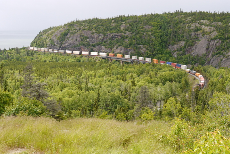
The road and the train track run parallel here. I see trains here that I have not seen before: really a kilometer long. I count about 100 cars, with containers stacked two-high. The whole thing is pulled by a two locomotives in front and pushed by a third. The trains are not moving fast, and when I overtake one I stop at a crossing to record the train's passage. Only then do I notice that there are also cars on which there is a generator supplying electricity to the refrigerated containers. If you are literally facing it, you not only hear that a brake is stuck on one of the wagons - you also smell the burned brake lining.
Farmers
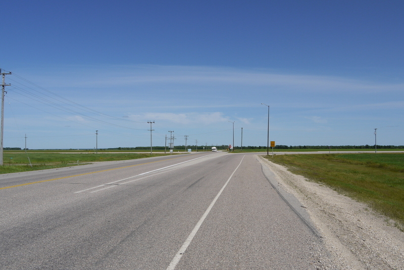
Just after the border between the provinces of Ontario and Manitoba, the scenery is suddenly flat. It's really flat here. I buy a detailed map of the province of Manitoba and it looks somewhat like the city map of an average American town. The space is divided into rectangular pieces. Only: here the blocks are almost 10 miles long, instead of the 0.5 miles in the city. I head, now that I can again, north. Within a few hours I am in the middle of every (Dutch polder) farmer's dream: fields up to the horizon.
Unfortunately, I have again driven too far: the only motel within a 100-kilometer radius has ... unwashed sheets. But the gruff owner Bob is very nice, although I am too tired to really respond to his story about his deceased wife and the fact that he hardly goes home now, but sleeps in one of the back rooms. Every person has a story to tell, even surly motel owners in mourning.
I had been told that crossing the middle part of Canada could be monotonous. I understand why people say that: it's flat here. But that in no way means there is nothing to see. I detour a bit, traveling on gravel roads through Duck Mountain and Porcupine National Parks. The endless fields are (temporarily) replaced by forests and some relief: I cross Baldy Mountain: at up to 831 meters, the highest point in this province. And again, traveling on less beaten trails yields encounters with wildlife: I see deer and another huge moose.
During a sanitary stop, a man on a three-wheeled ATV (all terrain vehicle) approaches me. I appear to be irrigating his field, but Rob doesn't say a word about it. Rob has 4 quarts, or 4 quarters of a square mile of land. (Canada has officially switched to the metric system, but many (somewhat older) people still use miles and body parts (feet, thumbs) as measures of length). So Rob farms 259 acres, which makes him, by his own admission, a small farmer. Last year it was wheat, but this year grows canola - a plant from which oil for human consumption is extracted.
Rob has a 7-meter-wide seeder and it takes him about two weeks to seed the area. “Yes, at times it is tedious work, but seeding and plowing only has to be done twice a year.” “How do the big farmers do that?”, I ask. Seeding in particular has to be done in a short time and so there are seeders up to 27 meters wide. You do need a sturdier tractor for that, and they do have those - sometimes as many as two or three.
Rob is not very busy at the moment and so is driving around a bit to inspect his crops. “The beginning of the season it was bad weather, then a beetle came and ate the young plants” - farmers are supposed to complain a bit. There's not much to do in the winter, either, because it's cold here. Very cold: afternoon temperatures around -20°C. Colder at night: up to -50°C.
There is a power cord hanging out of the front of many of the cars here. That's not because those cars are rechargeable, but to keep them warm in winter. Many engines would not start in the harsh cold of the morning. Suddenly I begin to understand what the power outlets on the outside walls of supermarkets are for: so the staff can drive home after work.
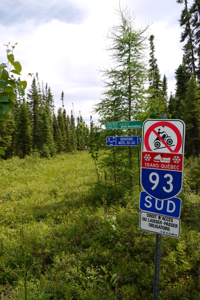
There are more things that are only used in winter: along many roads I see a kind of small traffic signs, in the middle of bushes. Quite a funny sight: in the green, completely overgrown, inaccessible shoulder is a lost sign: 'sharp turn'. When there is a pack of snow, an additional road network is created: for the 'Ski-Doo's (or 'moto-neige's). A farmer with whom I was staying in Quebec pulled out a (appropriately) white map on request with a complete network specifically for snowmobiles. “What good is that - the roads are passable, right?”, I asked. “Yes, but we use the scooter to take trips. Just look: there's a motel marked in here; the next morning you can take Trans-Québec number 3 through to this place, and eat at that restaurant on the way.... See? Last year we ...”, and he describes a hefty round. I'd like to be a farmer in Canada, too.
Service
Op 20 juli bereik ik Hudson Bay en vind er een piepklein motelletje. "Loopt uw klok goed?", vraag ik aan de man in overalls. "Ja hoor! Je komt zeker uit Manitoba? In de winter is er geen tijdverschil tussen Saskatchewan en Manitoba, maar in de zomer wel. Wij verzetten onze klokken nooit." Nu ik zo noordelijk ben, steek ik bijna iedere tweede dag een tijdgrens over, maar deze had ik niet gemerkt. Op mijn kaart staat de tijdzone getekend in de 'winterstand'. Ik krijg een uur cadeau.
 "Wat voor
werk doet u in de garage hiernaast?", vraag ik. "Allerlei - ik ben semi-gepensioneerd en heb dat
garagebedrijfje en het motel om me bezig te houden", antwoordt Murray (zijn naam is op zijn overall
geborduurd). "Wat voor olie gebruikt u?", wil ik weten, want ik heb al iets bedacht om met mijn extra uur
te doen. Helaas verkoopt Murray alleen voordelige olie: bijna iedereen wisselt de motorolie iedere 5.000
kilometer. Ik vertel hem dat mijn Europese auto slechts éénmaal per 30.000 km nieuwe olie krijgt. Hij
heeft daar wel eens van gehoord, en de meeste auto's hier zouden ook wel langer kunnen rijden, maar hier
wisselt iedereen nu éénmaal per 5.000 km.
"Wat voor
werk doet u in de garage hiernaast?", vraag ik. "Allerlei - ik ben semi-gepensioneerd en heb dat
garagebedrijfje en het motel om me bezig te houden", antwoordt Murray (zijn naam is op zijn overall
geborduurd). "Wat voor olie gebruikt u?", wil ik weten, want ik heb al iets bedacht om met mijn extra uur
te doen. Helaas verkoopt Murray alleen voordelige olie: bijna iedereen wisselt de motorolie iedere 5.000
kilometer. Ik vertel hem dat mijn Europese auto slechts éénmaal per 30.000 km nieuwe olie krijgt. Hij
heeft daar wel eens van gehoord, en de meeste auto's hier zouden ook wel langer kunnen rijden, maar hier
wisselt iedereen nu éénmaal per 5.000 km.
Murray heeft begrip voor het feit dat ik zeer goede olie wil die ik in Alaska niet opnieuw wil vervangen. Hij geeft me het adres van een winkel in Hudson Bay waar ik Mobil 1 kan kopen. Niet veel later sta ik in zijn werkplaats, met andermans olie, zelf te sleutelen aan mijn motor. In deze afgelegen gebieden is men gewend elkaar te helpen, in plaats van eerst aan tijd en/of geld te denken, maar Murray gaat er wel ver in. Als je ooit in Hudson Bay komt: Phillips Lodging - kraakheldere kamer, erg vriendelijke mensen.
Olie
Het noorden van Saskatchewan is ook plat maar wordt minder intensief voor landbouw gebruikt. Hier kan een meter niveau verschil het land onbruikbaar maken voor landbouw omdat er in de lager gelegen stukken vaak water staat. Da's voor een enorme zaaimachine lastig en dus wordt hier veel vee gehouden. De runderen lopen wel om het water heen, en eten alleen het gras dat voor hen bruikbaar is. De beesten 'wonen' in grote weiden, met wat bomen voor schaduw, een meertje voor drinkwater, ruimte om eens wat te rennen - ik zou ook wel ... ach, laat maar.
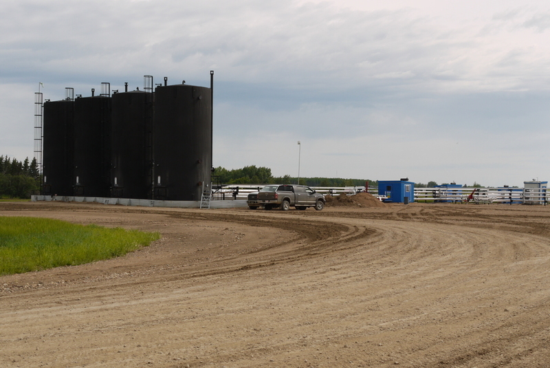 Naarmate ik
noordelijker kom, wordt het terrein ontoegankelijker en uiteindelijk is het ook met de grootschalige
veehouderij afgelopen. Maar er komt iets anders voor in de plaats: oliewinning. Verspreid in het
landschap staan olie silo's, met daarnaast een gastank en een pomphuis. De olie is hier zo dik dat ze
ondergronds verwarmd moet worden voordat het kan worden opgepompt. Dat maakt vervoer via een pijp ook
moeilijk, en dus rijden overal vrachtwagens af en aan. Er wordt hier en daar ook wel eens wat gemorst,
want het ruikt hier zelfs naar olie. Het is niet zo erg als in de Syrische woestijn langs de weg van
Bagdad naar Damascus, maar ik herken de geur.
Naarmate ik
noordelijker kom, wordt het terrein ontoegankelijker en uiteindelijk is het ook met de grootschalige
veehouderij afgelopen. Maar er komt iets anders voor in de plaats: oliewinning. Verspreid in het
landschap staan olie silo's, met daarnaast een gastank en een pomphuis. De olie is hier zo dik dat ze
ondergronds verwarmd moet worden voordat het kan worden opgepompt. Dat maakt vervoer via een pijp ook
moeilijk, en dus rijden overal vrachtwagens af en aan. Er wordt hier en daar ook wel eens wat gemorst,
want het ruikt hier zelfs naar olie. Het is niet zo erg als in de Syrische woestijn langs de weg van
Bagdad naar Damascus, maar ik herken de geur.
Isabella
Ik kom in de provincie Alberta terecht op 22 juli en logeer in High Prairie (het zijn leuke plaatsnamen hier, die vaak iets zeggen over de omgeving of de ontstaansreden, zoals een fort). In het motel hebben de kamers twee deuren: de achterdeur geeft via een soort veranda toegang tot de parkeerplaats. De motor 'slaapt' onderdak op de veranda, die ook een uitstekende plek is om de kleppen te stellen. Ik begin de ochtend met sleutelen - op één of twee puntjes na heeft de motor nu een complete servicebeurt gehad. Nadat ik het motel heb verlaten en een kwartiertje onderweg ben, stop ik om de synchronisatie van de (warmgereden) cilinders bij te stellen. Terwijl ik mijn gereedschap weer inpak, stopt er een motorrijder om te plassen. We besluiten samen een stukje te rijden en gaan later samen lunchen.
 "Ik moet over drie
dagen terug zijn, want ik moet de papieren voor de verdeling van mijn huis tekenen." Bob is net
gescheiden en het huis is verkocht. Bob is weer 'vrij man', al sombert hij nog een beetje. Hij stelt wel
heel veel vragen over hoe men zo'n wereldreis aanpakt: wat voor motor, hoeveel geld, wat voor uitrusting,
welke douane formaliteiten - hij wil beginnen in Europa. Ik raad hem aan door te rijden tot aan de
Iraanse grens. "Dus de opbrengst van mijn huis is genoeg voor een jaar", concludeert de houtzagerij
medewerker. Na de lunch rijden we gezamenlijk naar Dawson Creek, waar de Alaska Highway begint. Hier moet
Bob afslaan naar het zuiden, terwijl ik de Highway naar het noorden zal volgen.
"Ik moet over drie
dagen terug zijn, want ik moet de papieren voor de verdeling van mijn huis tekenen." Bob is net
gescheiden en het huis is verkocht. Bob is weer 'vrij man', al sombert hij nog een beetje. Hij stelt wel
heel veel vragen over hoe men zo'n wereldreis aanpakt: wat voor motor, hoeveel geld, wat voor uitrusting,
welke douane formaliteiten - hij wil beginnen in Europa. Ik raad hem aan door te rijden tot aan de
Iraanse grens. "Dus de opbrengst van mijn huis is genoeg voor een jaar", concludeert de houtzagerij
medewerker. Na de lunch rijden we gezamenlijk naar Dawson Creek, waar de Alaska Highway begint. Hier moet
Bob afslaan naar het zuiden, terwijl ik de Highway naar het noorden zal volgen.
De 2.451 km lange Alaska Highway is tijdens de Tweede Wereldoorlog gebouwd door de Verenigde Staten. Die hadden het gevoel dat hun achterdeur, Alaska, te kwetsbaar was voor aanvallen uit Azië. Men vond dat er een snelle verbinding moest komen voor militair materieel en mensen. De weg zou Alaska ook ontsluiten voor handelsdoeleinden: in die tijd werden er al veel mineralen (goud, koper) gedolven. (De ontdekking van de "North Slope" olie dateert pas uit de 60-er jaren.)
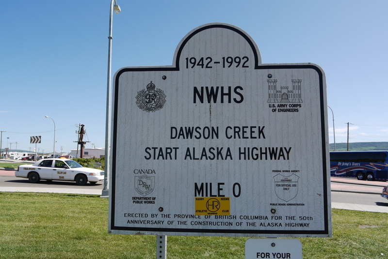 Om het begin van de weg te markeren is er een monumentje - het verplichte 'Kodak-moment' - ook voor Bob
en mij. Terwijl we wat babbelen met twee knapen die met een oude auto een retour New York - Alaska maken,
een paar macho motorrijders op zeer vieze motoren ("Wij hebben de Dalton gereden!") en wat huis-op-wielen
reizigers, duikt er een jonge vrouw op. Ze reist alleen, in een gewone personenauto. Ze heet Isabella,
een naam die mijn oren doet spitsen. Ik maak een foto van 'r en stel haar voor aan Bob. Bob en Isabella
kijken elkaar aan en ... de vonken vliegen eraf! Even later zijn ze samen weg - Bob's motor is kennelijk
aan mij toevertrouwd. Ik praat met nog wat mensen die vragen stellen over de wereldkaarten op mijn
motorkoffers. Als Bob weer opduikt heeft ie haast. "Ik ben weg - we gaan wat eten!". Bob's echtscheiding
is opeens volledig en hij is niet somber meer... (Zou het aan de naam liggen?)
Om het begin van de weg te markeren is er een monumentje - het verplichte 'Kodak-moment' - ook voor Bob
en mij. Terwijl we wat babbelen met twee knapen die met een oude auto een retour New York - Alaska maken,
een paar macho motorrijders op zeer vieze motoren ("Wij hebben de Dalton gereden!") en wat huis-op-wielen
reizigers, duikt er een jonge vrouw op. Ze reist alleen, in een gewone personenauto. Ze heet Isabella,
een naam die mijn oren doet spitsen. Ik maak een foto van 'r en stel haar voor aan Bob. Bob en Isabella
kijken elkaar aan en ... de vonken vliegen eraf! Even later zijn ze samen weg - Bob's motor is kennelijk
aan mij toevertrouwd. Ik praat met nog wat mensen die vragen stellen over de wereldkaarten op mijn
motorkoffers. Als Bob weer opduikt heeft ie haast. "Ik ben weg - we gaan wat eten!". Bob's echtscheiding
is opeens volledig en hij is niet somber meer... (Zou het aan de naam liggen?)